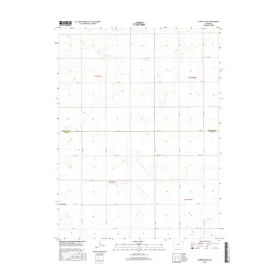
2016 Map of Clarkville NE
USGS Topo · Published 2016About this map
Clarkville sits at the southwestern edge of this landscape, where the High Plains terrain is etched by the drainage of Patent Creek. The area is defined by a rigorous grid of section lines and county roads, reflecting the systematic land division of the American West. The northern half of the map is dominated by the upper reaches of Patent Cr, which winds through open country toward the Phillips and Yuma County line. This 2016 survey documents a landscape focused on agricultural production and rural connectivity, with a dense network of local routes such as Co Rd 60 and Co Rd 11 providing the primary infrastructure for the scattered farmsteads and the community of Clarkville.
Find a feature on this map
23 named features on this map. Tap any name to fly to it.
Don’t see what you’re looking for? This feature index may not catch every label — zoom into the map to look around manually.
Map Details
Editions of this 2016 Clarkville NE Map
This is the sole edition of this map. No revisions or reprints were ever made.
Other maps of this area

1954 · Sterling
USGS Topo · 1:250,000

1958 · Sterling
USGS Topo · 1:250,000

1971 · Paoli
USGS Topo · 1:24,000

1971 · Fiddler Peak
USGS Topo · 1:24,000

1971 · Clarkville NE
USGS Topo · 1:24,000

1971 · Haxtun SE
USGS Topo · 1:24,000

1971 · Clarkville SE
USGS Topo · 1:24,000

1971 · Old Baldy
USGS Topo · 1:24,000

1972 · Clarkville
USGS Topo · 1:24,000

1972 · Rockland
USGS Topo · 1:24,000