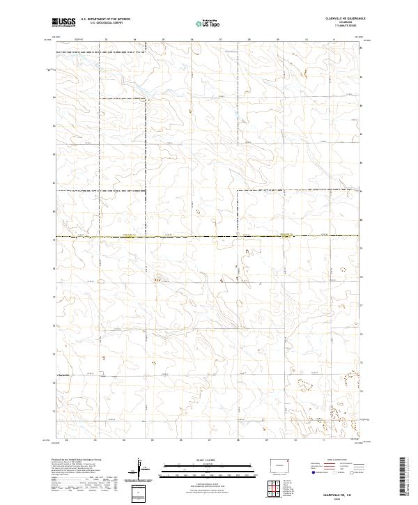
2022 Map of Clarkville NE
USGS Topo · Published 2022About this map
Phillips Co and Yuma Co meet in this 2022 survey of the Colorado high plains, where the grid of the Public Land Survey System defines the landscape. The small settlement of Clarkville anchors the southwestern portion of the sheet, situated at the junction of Co Rd 57 and Co Rd N. The terrain is characterized by the subtle drainage of Patent Creek, which meanders through the northern townships, cutting across Co Rd 11 and Co Rd 15 as it flows toward the northeast corner of the quadrangle. The map captures the highly regularized transport network of contemporary farming, dominated by numbered county roads that follow section lines. This geographic layout illustrates the enduring influence of the Homestead Act's township and range divisions on the modern agricultural borders of northeastern Colorado.
Find a feature on this map
23 named features on this map. Tap any name to fly to it.
Don’t see what you’re looking for? This feature index may not catch every label — zoom into the map to look around manually.
Map Details
Editions of this 2022 Clarkville NE Map
This is the sole edition of this map. No revisions or reprints were ever made.
Other maps of this area

1954 · Sterling
USGS Topo · 1:250,000

1958 · Sterling
USGS Topo · 1:250,000

1971 · Paoli
USGS Topo · 1:24,000

1971 · Fiddler Peak
USGS Topo · 1:24,000

1971 · Clarkville NE
USGS Topo · 1:24,000

1971 · Haxtun SE
USGS Topo · 1:24,000

1971 · Clarkville SE
USGS Topo · 1:24,000

1971 · Old Baldy
USGS Topo · 1:24,000

1972 · Clarkville
USGS Topo · 1:24,000

1972 · Rockland
USGS Topo · 1:24,000