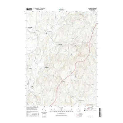
2016 Map of Claverack
USGS Topo · Published 2016About this map
Claverack Creek winds through this Hudson Valley landscape, connecting a series of hamlets established during the region's early industrial period. The map reveals the persistence of historic milling sites at Claverack-Red Mills, Linlithgo Mills, and Glenco Mills, where water power once drove local commerce. To the east, the village of Philmont sits near the dramatic High Falls, while the Taconic State Parkway cuts a modern path through the undulating terrain past Manor Rock and Pinnacle.
Find a feature on this map
106 named features on this map. Tap any name to fly to it.
Don’t see what you’re looking for? This feature index may not catch every label — zoom into the map to look around manually.
Map Details
Editions of this 2016 Claverack Map
This is the sole edition of this map. No revisions or reprints were ever made.
Other maps of this area

1893 · Coxsackie
USGS Topo · 1:62,500

1894 · Coxsackie
USGS Topo · 1:62,500

1895 · Catskill
USGS Topo · 1:62,500

1902 · Copake
USGS Topo · 1:62,500

1903 · Kinderhook
USGS Topo · 1:62,500

1904 · Copake
USGS Topo · 1:62,500

1929 · Coxsackie
USGS Topo · 1:62,500

1933 · Kinderhook
USGS Topo · 1:62,500

1934 · Catskill
USGS Topo · 1:62,500

1938 · Catskill
USGS Topo · 1:62,500