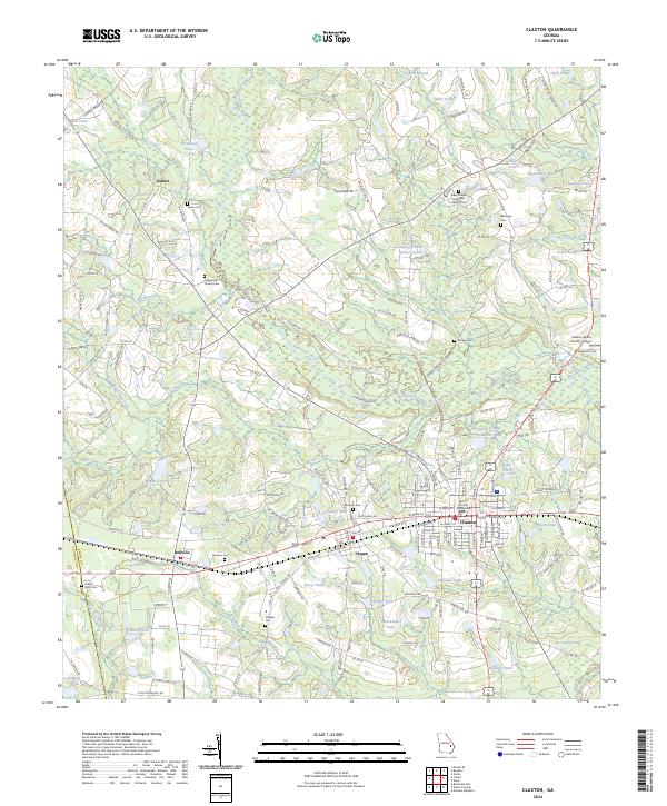
2024 Map of Claxton
USGS Topo · Published 2024About this map
Claxton and the neighboring settlements of Hagan and Bellville form a linear corridor of development along the southern reach of this survey, anchored by the Evans County Courthouse. This layout reflects the historical influence of transportation and governance in the region, where communities clustered along primary transit routes. In contrast, the northern portion of the map remains defined by the winding Canoochee River and a dense network of water bodies, including Yarbrough Pond, Beasley Pond, and Rogers Lake.
Find a feature on this map
202 named features on this map. Tap any name to fly to it.
Don’t see what you’re looking for? This feature index may not catch every label — zoom into the map to look around manually.
Map Details
Editions of this 2024 Claxton Map
This is the sole edition of this map. No revisions or reprints were ever made.
Other maps of this area

1919 · Claxton
USGS Topo · 1:62,500

1920 · Statesboro
USGS Topo · 1:62,500

1943 · Statesboro
USGS Topo · 1:62,500

1944 · Claxton
USGS Topo · 1:62,500

1947 · Savannah
USGS Topo · 1:250,000

1948 · Savannah
USGS Topo · 1:250,000

1950 · Claxton
USGS Topo · 1:62,500

1957 · Macon
USGS Topo · 1:250,000

1957 · Savannah
USGS Topo · 1:250,000

1958 · Macon
USGS Topo · 1:250,000