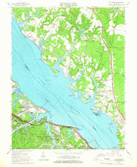
1965 Map of Clay Bank
USGS Topo · Published 1967About this map
The York River dominates this mid-1960s landscape, serving as a boundary between Gloucester and York Counties. The southern shore is defined by heavy federal activity at the US Naval Weapons Station and US Naval Supply Center Cheatham Annex, punctuated by the winding route of the Colonial Parkway. This military and preservation presence, including Colonial National Historical Park, contrasts with the agricultural and residential character of the Gloucester side to the north.
Find a feature on this map
76 named features on this map. Tap any name to fly to it.
Don’t see what you’re looking for? This feature index may not catch every label — zoom into the map to look around manually.
Map Details
Editions of this 1965 Clay Bank Map
3 editions found
Other maps of this area

1906 · Williamsburg
USGS Topo · 1:62,500

1907 · Yorktown
USGS Topo · 1:62,500

1907 · Hampton
USGS Topo · 1:62,500

1916 · Mathews
USGS Topo · 1:62,500

1917 · Mathews
USGS Topo · 1:62,500

1943 · Yorktown
USGS Topo · 1:62,500

1943 · Richmond
USGS Topo · 1:250,000

1944 · Yorktown
USGS Topo · 1:24,000

1944 · Harris Grove
USGS Topo · 1:24,000

1948 · Ware Neck
USGS Topo · 1:24,000