
1968 Map of Clay Buttes
USGS Topo · Published 1971About this map
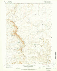
Clay Buttes rises above a landscape defined by arroyos and energy exploration in the high desert of Sweetwater County. This 1968 field-checked survey documents a transition in land use where old transport routes like Stagecoach Draw intersect with a network of resource extraction. The map identifies several early industrial markers, including Chilton Well, Jensen Well, and several Flowing Wells, indicating the importance of groundwater and mineral rights in this arid territory. Drainage patterns are clearly delineated by the winding paths of Sixmile Draw and Jensen Wash, which carve through the basin. Large-scale earthmoving is evidenced by multiple Borrow Pits and Drill Holes scattered across the township, recording the physical footprint of mid-century infrastructure and energy development in Wyoming.
Find a feature on this map
13 named features on this map. Tap any name to fly to it.
Don’t see what you’re looking for? This feature index may not catch every label — zoom into the map to look around manually.
Map Details
Editions of this 1968 Clay Buttes Map
This is the sole edition of this map. No revisions or reprints were ever made.
Other maps of this area

1954 · Rock Springs
USGS Topo · 1:250,000

1955 · Lander
USGS Topo · 1:250,000

1958 · Lander
USGS Topo · 1:250,000

1958 · Rock Springs
USGS Topo · 1:250,000

1961 · Lander
USGS Topo · 1:250,000

1962 · Rock Springs
USGS Topo · 1:250,000

1963 · Pittman Well
USGS Topo · 1:24,000
1963 · Chrisman Ranch
USGS Topo · 1:24,000

1968 · Farson
USGS Topo · 1:24,000

1968 · White Rocks
USGS Topo · 1:24,000