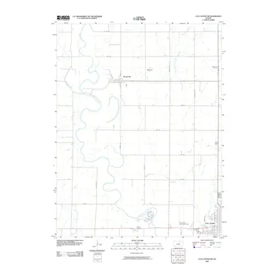
2009 Map of Clay Center NW
USGS Topo · Published 2009About this map
The Republican River carves a winding path through this section of Clay County, defining a landscape marked by agrarian grids and established rural communities. The settlement of Morganville sits centrally, serving as a focal point for the surrounding farmsteads linked by a network of named roads like Jayhawk Rd and Limestone Rd. To the southeast, the outskirts of Clay Center begin to appear, transitioning from the open valley to a more concentrated municipal layout near the Clay Center Municipal Airport.
Find a feature on this map
39 named features on this map. Tap any name to fly to it.
Don’t see what you’re looking for? This feature index may not catch every label — zoom into the map to look around manually.
Map Details
Editions of this 2009 Clay Center NW Map
This is the sole edition of this map. No revisions or reprints were ever made.
Other maps of this area

1891 · Clay Center
USGS Topo · 1:125,000

1893 · Washington
USGS Topo · 1:125,000

1955 · Manhattan
USGS Topo · 1:250,000

1956 · Manhattan
USGS Topo · 1:250,000

1957 · Manhattan
USGS Topo · 1:250,000

1964 · Clay Center NW
USGS Topo · 1:24,000

1964 · Clay Center SW
USGS Topo · 1:24,000
1964 · Clay Center SE
USGS Topo · 1:24,000
1964 · Clay Center NE
USGS Topo · 1:24,000

1964 · Idana
USGS Topo · 1:24,000