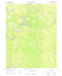
1967 Map of Clay
USGS Topo · Published 1977About this map
The Elk River carves a winding path through the center of this terrain, its horseshoe loops defining the geography of Clay and its surrounding communities during the late 1960s. The B & O railroad tracks parallel the riverbank, serving as a vital artery for the region's extraction-based economy, connecting Clay Junction and Dundon to the broader industrial network. Numerous gas and oil wells are peppered throughout the hollows and ridges, such as Pisgah Ridge and Longs Ridge, indicating the heavy reliance on natural resource development in this West Virginia landscape.
Find a feature on this map
59 named features on this map. Tap any name to fly to it.
Don’t see what you’re looking for? This feature index may not catch every label — zoom into the map to look around manually.
Map Details
Editions of this 1967 Clay Map
2 editions found
Other maps of this area

1889 · Nicholas
USGS Topo · 1:125,000

1891 · Nicholas
USGS Topo · 1:125,000

1893 · Sutton
USGS Topo · 1:125,000

1897 · Kanawha Falls
USGS Topo · 1:125,000

1900 · Kanawha Falls
USGS Topo · 1:125,000

1901 · Nicholas
USGS Topo · 1:125,000

1901 · Kanawha Falls
USGS Topo · 1:125,000

1906 · Otter
USGS Topo · 1:62,500

1907 · Otter
USGS Topo · 1:62,500

1908 · Clay
USGS Topo · 1:48,000