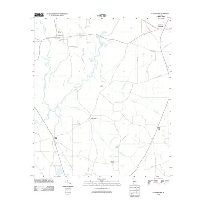
2011 Map of Clayhatchee
USGS Topo · Published 2011About this map
The Choctawhatchee River carves a winding path through this corner of Southeast Alabama, defining a landscape of agricultural roads and scattered family-named crossroads. Near the northern bend of the river, the settlement of Clayhatchee serves as a local anchor, while smaller communities such as Backems Crossroads and High Bluff populate the higher ground. The map reveals a high concentration of burial grounds important for genealogical research, including Shiloh Cemetery, Mount Gilead Cemetery, Whaley Cemetery, and Macedonia Cemetery. Drainage from the surrounding fields feeds into numerous named tributaries such as Claybank Creek, Pates Creek, and Hurricane Creek. Notable landmarks like Bald Hill and the dip of Posey Hollow contrast with the largely flat agricultural layout, illustrating the rural character of the region in the early 21st century.
Find a feature on this map
58 named features on this map. Tap any name to fly to it.
Don’t see what you’re looking for? This feature index may not catch every label — zoom into the map to look around manually.
Map Details
Editions of this 2011 Clayhatchee Map
This is the sole edition of this map. No revisions or reprints were ever made.
Other maps of this area

1942 · Enterprise
USGS Topo · 1:125,000

1948 · Ozark
USGS Topo · 1:62,500

1950 · Ozark
USGS Topo · 1:62,500

1950 · Enterprise
USGS Topo · 1:62,500

1953 · Dothan
USGS Topo · 1:250,000

1954 · Dothan
USGS Topo · 1:250,000

1955 · Dothan
USGS Topo · 1:250,000

1957 · Malvern
USGS Topo · 1:24,000

1957 · Geneva
USGS Topo · 1:62,500

1957 · Hartford
USGS Topo · 1:62,500