
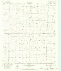
1963 Map of Clays Corner
USGS Topo · Published 1965About this map
Running Water Draw carves a distinct path across this West Texas landscape, defining the topography of Parmer County during the early 1960s. The region is characterized by an extensive network of irrigation wells, reflecting the intensive agricultural development managed by the High Plains Underground Water Conservation District No. 1 and the Texas Water Commission. The small settlement at Clays Corner serves as a local navigational landmark at the junction of area roads, surrounded by a grid of fence lines and ranching infrastructure. Other functional features of the era include a Water Tank and a Gravel Pit located near the draw, illustrating the local extraction and resource management necessary to support this semi-arid environment. This 1963 survey, based on 1962 aerial photography, provides a clear record of the rural land divisions and water-dependent infrastructure that sustained the High Plains economy.
Find a feature on this map
5 named features on this map. Tap any name to fly to it.
Don’t see what you’re looking for? This feature index may not catch every label — zoom into the map to look around manually.
Map Details
Editions of this 1963 Clays Corner Map
This is the sole edition of this map. No revisions or reprints were ever made.
Other maps of this area

1954 · Clovis
USGS Topo · 1:250,000

1958 · Clovis
USGS Topo · 1:250,000

1963 · Lazbuddie
USGS Topo · 1:24,000

1963 · Lariat NE
USGS Topo · 1:24,000

1963 · Lazbuddie SW
USGS Topo · 1:24,000

1963 · Progress
USGS Topo · 1:24,000
1963 · Lazbuddie SE
USGS Topo · 1:24,000

1965 · Tam Anne
USGS Topo · 1:24,000

1965 · Parmerton
USGS Topo · 1:24,000

1965 · Hub
USGS Topo · 1:24,000