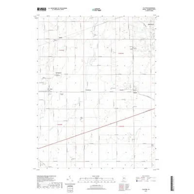
2019 Map of Clayton
USGS Topo · Published 2019About this map
Clayton and Amo serve as the primary hubs of this Hendricks County landscape, where the agricultural grid is defined by the drainage of E Fork Mill Cr and Mud Cr. The 2019 survey shows a region rich in genealogical markers, with numerous burial grounds such as Christie West Cem and Christie East Cem near the northern edge, and the Bethel Lutheran Cem to the south. Small settlements like Springtown, Pecksburg, and Summit dot the intersections of a dense county road network, while Danville occupies the northeastern corner. Transportation and local utility are reflected in the presence of Marcidale Airport and Cooper Airport, alongside the diagonal path of the Old National Rd. The map also captures several recreation paths near the West Fork White Lick Creek, including Trail 1, Trail 5, and Trail 6.
Find a feature on this map
56 named features on this map. Tap any name to fly to it.
Don’t see what you’re looking for? This feature index may not catch every label — zoom into the map to look around manually.
Map Details
Editions of this 2019 Clayton Map
This is the sole edition of this map. No revisions or reprints were ever made.
Other maps of this area

1953 · Clayton
USGS Topo · 1:24,000

1953 · Danville
USGS Topo · 1:24,000

1953 · Brownsburg
USGS Topo · 1:24,000

1953 · Plainfield
USGS Topo · 1:24,000

1953 · Indianapolis
USGS Topo · 1:250,000

1955 · Hall
USGS Topo · 1:24,000

1955 · Mooresville West
USGS Topo · 1:24,000

1956 · Indianapolis
USGS Topo · 1:250,000

1956 · Eminence
USGS Topo · 1:24,000

1957 · Indianapolis
USGS Topo · 1:250,000