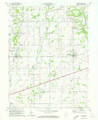
1970 Map of Clayton
USGS Topo · Published 1972About this map
The Penn Central railroad and the historic National Road define the settlement pattern across southern Hendricks County during this 1970 revision. This landscape is a patchwork of small agrarian communities like Clayton, Amo, and Pecksburg, many of which developed as vital stops along the rail corridor. The map preserves the locations of local landmarks that served these rural populations, including the Drive-in Theater near Liberty township and the Cascade Sch. Local family history is well-represented through several burial grounds such as Old Spring Cem and Hillside Cem. The drainage of the area is led by the East Fork Mill Creek and Mud Creek, which move through the townships of Clay and Marion, illustrating the topographical relationship between the watercourses and the established transport routes.
Find a feature on this map
28 named features on this map. Tap any name to fly to it.
Don’t see what you’re looking for? This feature index may not catch every label — zoom into the map to look around manually.
Map Details
Editions of this 1970 Clayton Map
This is the sole edition of this map. No revisions or reprints were ever made.
Other maps of this area

1953 · Clayton
USGS Topo · 1:24,000

1953 · Danville
USGS Topo · 1:24,000

1953 · Brownsburg
USGS Topo · 1:24,000

1953 · Plainfield
USGS Topo · 1:24,000

1953 · Indianapolis
USGS Topo · 1:250,000

1955 · Hall
USGS Topo · 1:24,000

1955 · Mooresville West
USGS Topo · 1:24,000

1956 · Indianapolis
USGS Topo · 1:250,000

1956 · Eminence
USGS Topo · 1:24,000

1957 · Indianapolis
USGS Topo · 1:250,000