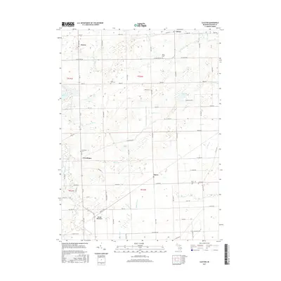
2017 Map of Clayton
USGS Topo · Published 2017About this map
Clayton and the surrounding townships of Lenawee County are defined by a complex drainage system that feeds the S Br River Raisin and Stony Cr. This 2017 survey reveals the enduring rural character of the region, where small historic settlements like Canandaigua and Seneca persist alongside modern agricultural holdings. The landscape is punctuated by numerous family and community burial grounds, including Canandaigua Cem, Porter Cem, and Gage Cem, which serve as vital markers for local genealogists. The southwestern portion of the map is dominated by the waters of Lake Hudson, while the central terrain is marked by significant wetland areas like the Big Swamp Drain, illustrating the hydrological management required for the area's development. Secondary roads such as W Carleton Rd and M 156 connect these quiet hamlets across the grid of township sections.
Find a feature on this map
78 named features on this map. Tap any name to fly to it.
Don’t see what you’re looking for? This feature index may not catch every label — zoom into the map to look around manually.
Map Details
Editions of this 2017 Clayton Map
This is the sole edition of this map. No revisions or reprints were ever made.
Other maps of this area

1911 · Wauseon
USGS Topo · 1:62,500

1913 · Wauseon
USGS Topo · 1:62,500

1913 · Alvordton
USGS Topo · 1:62,500

1943 · Wauseon
USGS Topo · 1:62,500

1944 · Alvordton
USGS Topo · 1:62,500

1953 · Fort Wayne
USGS Topo · 1:250,000

1956 · Fort Wayne
USGS Topo · 1:250,000

1960 · Morenci
USGS Topo · 1:24,000

1960 · Fayette
USGS Topo · 1:24,000
1960 · Lyons
USGS Topo · 1:24,000