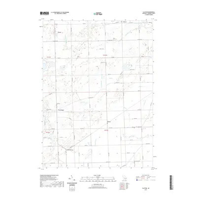
2019 Map of Clayton
USGS Topo · Published 2019About this map
Clayton and Seneca anchor this survey of southwestern Lenawee County, where a dense network of country roads like Morenci HWY and Seneca HWY connects several historic crossroads settlements. The landscape is defined by its intricate drainage patterns, featuring the S Br River Raisin in the north and the Tiffin River to the south. Numerous named drains and creeks, including Bear Cr and Stony Cr, weave through the township, reflecting the agricultural character of this Michigan borderland.
Find a feature on this map
79 named features on this map. Tap any name to fly to it.
Don’t see what you’re looking for? This feature index may not catch every label — zoom into the map to look around manually.
Map Details
Editions of this 2019 Clayton Map
This is the sole edition of this map. No revisions or reprints were ever made.
Other maps of this area

1911 · Wauseon
USGS Topo · 1:62,500

1913 · Wauseon
USGS Topo · 1:62,500

1913 · Alvordton
USGS Topo · 1:62,500

1943 · Wauseon
USGS Topo · 1:62,500

1944 · Alvordton
USGS Topo · 1:62,500

1953 · Fort Wayne
USGS Topo · 1:250,000

1956 · Fort Wayne
USGS Topo · 1:250,000

1960 · Morenci
USGS Topo · 1:24,000

1960 · Fayette
USGS Topo · 1:24,000
1960 · Lyons
USGS Topo · 1:24,000