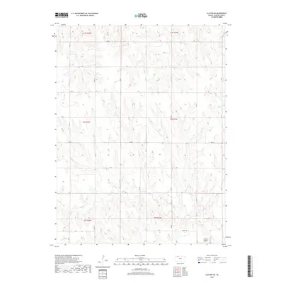
2018 Map of Clayton NE
USGS Topo · Published 2018About this map
The northern plains of Norton County are defined by the winding course of Elk Cr, which carves through the section lines of the high prairie. This 2018 survey reveals a landscape meticulously organized by the Public Land Survey System, with township boundaries like t4s r25w and t3s r24w anchoring a grid of rural routes. The southeastern corner of the map features the Lenora Municipal Airport, accessed by the aptly named Airport Rd. This aerial facility serves as a modern waypoint in a region otherwise dominated by long-established agricultural corridors such as Road W and Road S. The map provides a precise look at the contemporary interface between traditional land divisions and regional transportation infrastructure in Western Kansas.
Find a feature on this map
17 named features on this map. Tap any name to fly to it.
Don’t see what you’re looking for? This feature index may not catch every label — zoom into the map to look around manually.
Map Details
Editions of this 2018 Clayton NE Map
This is the sole edition of this map. No revisions or reprints were ever made.
Other maps of this area

1893 · Norton
USGS Topo · 1:125,000

1951 · Norton
USGS Topo · 1:62,500

1951 · Norcatur
USGS Topo · 1:62,500

1954 · Goodland
USGS Topo · 1:250,000

1955 · Beloit
USGS Topo · 1:250,000

1956 · Goodland
USGS Topo · 1:250,000

1957 · Goodland
USGS Topo · 1:250,000

1959 · Beloit
USGS Topo · 1:250,000

1978 · Clayton SW
USGS Topo · 1:24,000

1978 · Clayton
USGS Topo · 1:24,000