
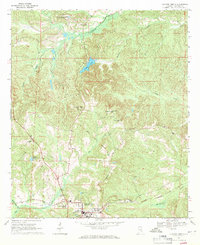
1968 Map of Clayton North
USGS Topo · Published 1970About this map
The town of Clayton serves as the hub for this section of Barbour County, shown here during the late 1960s. The landscape is defined by the headwaters of Pea Creek and Johnson Creek, featuring a distinct network of rural landmarks like Marianna Ch and the County Training Sch. A significant historical alignment, the Old Indian Treaty Boundary Road, cuts through the center of the sheet, reflecting early frontier surveying patterns that still influenced the local road network over a century later.
Find a feature on this map
28 named features on this map. Tap any name to fly to it.
Don’t see what you’re looking for? This feature index may not catch every label — zoom into the map to look around manually.
Map Details
Editions of this 1968 Clayton North Map
2 editions found
Other maps of this area

1953 · Dothan
USGS Topo · 1:250,000

1954 · Dothan
USGS Topo · 1:250,000

1955 · Dothan
USGS Topo · 1:250,000

1955 · Phenix City
USGS Topo · 1:250,000

1957 · Phenix City
USGS Topo · 1:250,000

1958 · Phenix City
USGS Topo · 1:250,000

1967 · Clayton South
USGS Topo · 1:24,000

1968 · Baker Hill
USGS Topo · 1:24,000

1968 · White Oak
USGS Topo · 1:24,000

1968 · Louisville
USGS Topo · 1:24,000