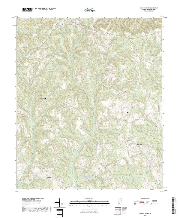
2024 Map of Clayton South
USGS Topo · Published 2024About this map
Barbour County's rolling landscape south of the town of Clayton is defined by a dense network of creeks and small family-named landmarks. The terrain is marked by significant water features such as Adams Millpond and Louisville Club Pond, alongside the winding courses of Pauls Creek and Lindsey Creek. These waterways, including Winn Creek and Gin Creek, have historically shaped the settlement patterns and local transit routes throughout this rural Alabama corridor.
Find a feature on this map
38 named features on this map. Tap any name to fly to it.
Don’t see what you’re looking for? This feature index may not catch every label — zoom into the map to look around manually.
Map Details
Editions of this 2024 Clayton South Map
This is the sole edition of this map. No revisions or reprints were ever made.
Other maps of this area

1953 · Dothan
USGS Topo · 1:250,000

1954 · Dothan
USGS Topo · 1:250,000

1955 · Dothan
USGS Topo · 1:250,000

1967 · Clayton South
USGS Topo · 1:24,000

1968 · Baker Hill
USGS Topo · 1:24,000

1968 · White Oak
USGS Topo · 1:24,000

1968 · Clayton North
USGS Topo · 1:24,000

1968 · Louisville
USGS Topo · 1:24,000

1968 · Mount Andrew
USGS Topo · 1:24,000
1969 · Clio
USGS Topo · 1:24,000