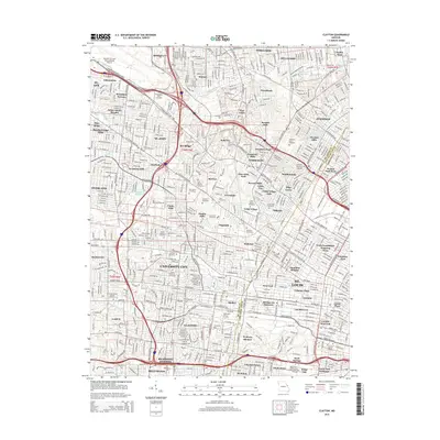
2015 Map of Clayton
USGS Topo · Published 2015About this map
Washington Park Cemetery and Memorial Park Cemetery are just two of several large memorial grounds that define the suburban landscape of Saint Louis County in this 2015 study. The map illustrates a densely populated corridor north and west of the St Louis County boundary, featuring a concentration of higher education institutions including Washington Univ In St Louis, the Univ of Missouri-St Louis, and Fontbonne Univ. Transportation networks are dominated by the Lambert-St Louis International Airport in the northwest, with Natural Bridge Rd and St Charles Rock Rd serving as primary thoroughfares connecting numerous small municipalities like Kinloch, Bel-Ridge, and Bellerive. The drainage patterns of Moline Cr and Coldwater Cr offer a contrast to the grid of residential streets and sprawling university campuses.
Find a feature on this map
101 named features on this map. Tap any name to fly to it.
Don’t see what you’re looking for? This feature index may not catch every label — zoom into the map to look around manually.
Map Details
Editions of this 2015 Clayton Map
This is the sole edition of this map. No revisions or reprints were ever made.
Other maps of this area

1888 · St. Louis
USGS Topo · 1:62,500

1924 · Robertson
USGS Topo · 1:24,000

1927 · Alton
USGS Topo · 1:62,500

1927 · St. Charles
USGS Topo · 1:62,500

1933 · Creve Coeur
USGS Topo · 1:24,000

1933 · Granite City
USGS Topo · 1:24,000

1933 · Jefferson Barracks
USGS Topo · 1:24,000

1933 · Cahokia
USGS Topo · 1:24,000

1933 · Clayton
USGS Topo · 1:24,000

1933 · Saint Charles
USGS Topo · 1:62,500