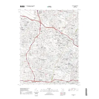
2017 Map of Clayton
USGS Topo · Published 2017About this map
The boundary between the City of St. Louis and Saint Louis County divides this dense urban and suburban landscape, revealing the complex mosaic of mid-century municipalities. A significant concentration of commemorative sites occupies the central corridor, including Washington Park Cem, Lake Charles Cem, and Valhalla Cem, preserving large tracts of open space amidst established neighborhoods like Kinloch, Bel-Nor, and St. John. In the northwest, the massive footprint of the Lambert-St. Louis International Airport dominates the terrain, its runways shaped by the proximity of Coldwater Cr. Cultural and educational institutions serve as anchors for these communities, notably the University of Missouri - Saint Louis and the sprawling Forest Park in the southeast. A heavy network of modern thoroughfares, including Interstate 70 and Interstate 170, dictates the movement and development patterns of this metropolitan region.
Find a feature on this map
108 named features on this map. Tap any name to fly to it.
Don’t see what you’re looking for? This feature index may not catch every label — zoom into the map to look around manually.
Map Details
Editions of this 2017 Clayton Map
This is the sole edition of this map. No revisions or reprints were ever made.
Other maps of this area

1888 · St. Louis
USGS Topo · 1:62,500

1924 · Robertson
USGS Topo · 1:24,000

1927 · Alton
USGS Topo · 1:62,500

1927 · St. Charles
USGS Topo · 1:62,500

1933 · Creve Coeur
USGS Topo · 1:24,000

1933 · Granite City
USGS Topo · 1:24,000

1933 · Jefferson Barracks
USGS Topo · 1:24,000

1933 · Cahokia
USGS Topo · 1:24,000

1933 · Clayton
USGS Topo · 1:24,000

1933 · Saint Charles
USGS Topo · 1:62,500