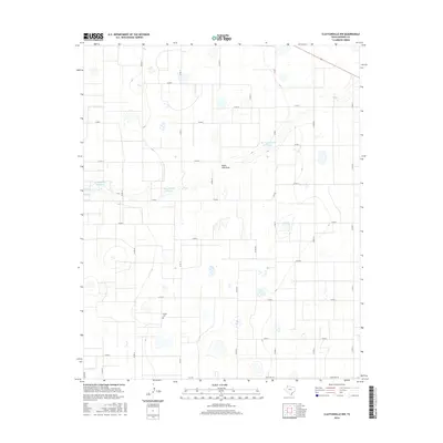
2016 Map of Claytonville NW
USGS Topo · Published 2016About this map
Wright Cem sits in the southwest quadrant of this Swisher County landscape, a localized marker of family history amidst the high plains of the Texas Panhandle. The terrain is defined by the winding course of South Tule Draw, which cuts a drainage path through an otherwise orderly grid of section lines and county roads. This 2016 survey illustrates the importance of water management in the region, featuring several large impoundments including H T Copeland Reservoir, Roy Stockett Reservoir, and the Tulia Feedlot Reservoir. The map reveals a strictly agricultural infrastructure, where cattle production and ranching are supported by a dense network of local connectors like Co RD 18 and Co RD 19, alongside state-maintained routes such as Fm 928 and Ranch Rd 145.
Find a feature on this map
28 named features on this map. Tap any name to fly to it.
Don’t see what you’re looking for? This feature index may not catch every label — zoom into the map to look around manually.
Map Details
Editions of this 2016 Claytonville NW Map
This is the sole edition of this map. No revisions or reprints were ever made.
Other maps of this area

1954 · Plainview
USGS Topo · 1:250,000

1958 · Plainview
USGS Topo · 1:250,000

1965 · Edmonson NE
USGS Topo · 1:24,000

1965 · Kress West
USGS Topo · 1:24,000

1965 · Tulia
USGS Topo · 1:24,000

1968 · Tule Lake
USGS Topo · 1:24,000

1969 · Love
USGS Topo · 1:24,000

1969 · Kress East
USGS Topo · 1:24,000

1969 · Claytonville
USGS Topo · 1:24,000

1969 · Claytonville NW
USGS Topo · 1:24,000