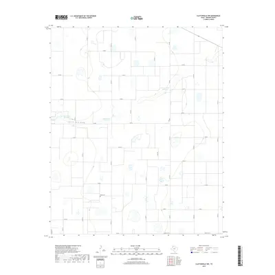
2019 Map of Claytonville NW
USGS Topo · Published 2019About this map
South Tule Draw meanders across this High Plains landscape in Swisher County, where water management is central to the local economy. Several named impoundments, including the H T Copeland Reservoir, Roy Stockett Reservoir, and Tulia Feedlot Reservoir, are scattered across the terrain, reflecting the area's agricultural and ranching requirements. These water features are connected by a grid of rural routes and farm-to-market roads, such as Fm 928 and Fm 145, which facilitate movement between these isolated hubs. For those looking for family history or local landmarks, the Wright Cem sits just north of the county road network, providing a specific point of interest in an otherwise sparsely populated section of the Panhandle. The map captures the specialized infrastructure of West Texas, where feedlot operations and private reservoirs dictate the organization of the land.
Find a feature on this map
27 named features on this map. Tap any name to fly to it.
Don’t see what you’re looking for? This feature index may not catch every label — zoom into the map to look around manually.
Map Details
Editions of this 2019 Claytonville NW Map
This is the sole edition of this map. No revisions or reprints were ever made.
Other maps of this area

1954 · Plainview
USGS Topo · 1:250,000

1958 · Plainview
USGS Topo · 1:250,000

1965 · Edmonson NE
USGS Topo · 1:24,000

1965 · Kress West
USGS Topo · 1:24,000

1965 · Tulia
USGS Topo · 1:24,000

1968 · Tule Lake
USGS Topo · 1:24,000

1969 · Love
USGS Topo · 1:24,000

1969 · Kress East
USGS Topo · 1:24,000

1969 · Claytonville
USGS Topo · 1:24,000

1969 · Claytonville NW
USGS Topo · 1:24,000