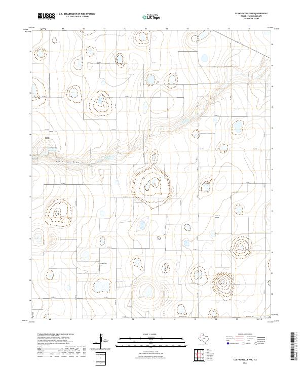
2022 Map of Claytonville NW
USGS Topo · Published 2022About this map
South Tule Draw meanders across this high plains landscape in Swisher County, where a system of engineered water management features defines the rural economy. Small basins and catchments like the Tulia Feedlot Reservoir, Roy Stockett Reservoir, and H T Copeland Reservoir are scattered throughout the territory, supporting agricultural operations in this semi-arid region of the Texas Panhandle. A significant genealogical landmark, the Wright Cem, sits in the southern portion of the quadrangle near the intersection of several county roads.
Find a feature on this map
27 named features on this map. Tap any name to fly to it.
Don’t see what you’re looking for? This feature index may not catch every label — zoom into the map to look around manually.
Map Details
Editions of this 2022 Claytonville NW Map
This is the sole edition of this map. No revisions or reprints were ever made.
Other maps of this area

1954 · Plainview
USGS Topo · 1:250,000

1958 · Plainview
USGS Topo · 1:250,000

1965 · Edmonson NE
USGS Topo · 1:24,000

1965 · Kress West
USGS Topo · 1:24,000

1965 · Tulia
USGS Topo · 1:24,000

1968 · Tule Lake
USGS Topo · 1:24,000

1969 · Love
USGS Topo · 1:24,000

1969 · Kress East
USGS Topo · 1:24,000

1969 · Claytonville
USGS Topo · 1:24,000

1969 · Claytonville NW
USGS Topo · 1:24,000