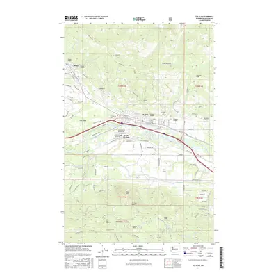
2017 Map of Cle Elum
USGS Topo · Published 2017About this map
Roslyn and Cle Elum are shown during a period of modern expansion that still reflects their deep coal mining and timber roots. The landscape is defined by the Yakima River corridor and the steep ridges of the Wenatchee National Forest, where features like Peoh Point and Taneum Point overlook the valley floor. The influence of the mining era remains visible in the street names and infrastructure, such as No 9 Mine Rd and Coal Mine Way in the northwest, while the BNSF Railway continues to follow the river through South Cle Elum. Local history is anchored at the Laurel Hill Memorial Cem and the Cle Elum-Roslyn High School, centering the community between the rugged canyons of the Cascades and the developed flats of the Cle Elum Municipal Airport.
Find a feature on this map
121 named features on this map. Tap any name to fly to it.
Don’t see what you’re looking for? This feature index may not catch every label — zoom into the map to look around manually.
Map Details
Editions of this 2017 Cle Elum Map
This is the sole edition of this map. No revisions or reprints were ever made.
Other maps of this area

1897 · Mount Stuart
USGS Topo · 1:125,000

1901 · Snoqualmie Pass
USGS Topo · 1:125,000

1902 · Mount Stuart
USGS Topo · 1:125,000

1903 · Snoqualmie
USGS Topo · 1:125,000

1957 · Wenatchee
USGS Topo · 1:250,000

1958 · Cle Elum
USGS Topo · 1:62,500

1961 · Mount Stuart
USGS Topo · 1:62,500

1961 · Easton
USGS Topo · 1:62,500

1961 · Kachess Lake
USGS Topo · 1:62,500

1975 · Snoqualmie Pass
USGS Topo · 1:100,000