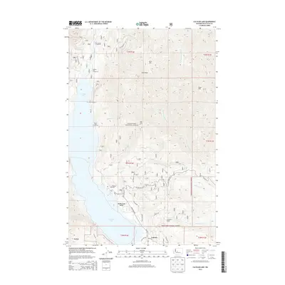
2014 Map of Cle Elum Lake
USGS Topo · Published 2014About this map
Cle Elum Lake dominates this portion of the Wenatchee National Forest, serving as the central geographic feature for a landscape defined by timbered ridges and recreational access. Small residential pockets like Driftwood Acres and Lakedale occupy the flatter ground near the water, while the southwestern corner touches the edge of Roslyn. The map documents a dense network of Forest Service roads, including Nat For Dev Rd 4305 and Nat For Dev Rd 113, which provide access to numerous riverside and lakeside retreats such as the Wish Poosh Campground and Red Mountain Campground. Significant topographical landmarks include the prominent Sasse Mtn and Hex Mtn, overlooking the various drainages of the W Fork Teanaway River and Cle Elum River. This survey illustrates the modern intersection of industrial forest management and the region's long-standing draw as a mountain getaway.
Find a feature on this map
50 named features on this map. Tap any name to fly to it.
Don’t see what you’re looking for? This feature index may not catch every label — zoom into the map to look around manually.
Map Details
Editions of this 2014 Cle Elum Lake Map
This is the sole edition of this map. No revisions or reprints were ever made.
Other maps of this area

1897 · Mount Stuart
USGS Topo · 1:125,000

1901 · Snoqualmie Pass
USGS Topo · 1:125,000

1902 · Mount Stuart
USGS Topo · 1:125,000

1903 · Snoqualmie
USGS Topo · 1:125,000

1957 · Wenatchee
USGS Topo · 1:250,000

1958 · Cle Elum
USGS Topo · 1:62,500

1961 · Mount Stuart
USGS Topo · 1:62,500

1961 · Easton
USGS Topo · 1:62,500

1961 · Kachess Lake
USGS Topo · 1:62,500

1975 · Snoqualmie Pass
USGS Topo · 1:100,000