
1912 Map of Clear Creek
USGS Topo · Published 1912About this map
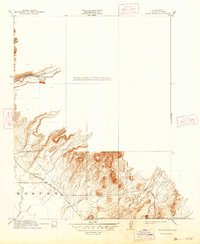
Centerville Road and the Chico and Oroville Road bisect the foothills of Butte County in this 1910 survey. The map details a landscape defined by sharp elevation changes and the watercourses that carved them, including Butte Creek to the north and the complex drainage of Ash Creek and Clear Creek further south. Near the southern edge, the Esquon area is marked with precise topographic contours, illustrating the transition from higher elevations toward the valley floor. Researchers will find the alignment of the Magalia Road particularly useful for tracing early automotive and wagon routes through the county. The survey provides a clear view of the transportation corridors established just after the turn of the century, showing how early roads followed the natural contours of the land around Dry Cr and Roberts Creek.
Find a feature on this map
9 named features on this map. Tap any name to fly to it.
Don’t see what you’re looking for? This feature index may not catch every label — zoom into the map to look around manually.
Map Details
Editions of this 1912 Clear Creek Map
2 editions found
Other maps of this area

1891 · Chico
USGS Topo · 1:125,000

1893 · Chico
USGS Topo · 1:125,000

1895 · Chico
USGS Topo · 1:125,000

1912 · Dry Creek
USGS Topo · 1:31,680

1912 · Durham
USGS Topo · 1:31,680

1912 · Oroville
USGS Topo · 1:31,680

1912 · Nelson
USGS Topo · 1:31,680

1912 · Keefers
USGS Topo · 1:31,680

1942 · Oroville
USGS Topo · 1:62,500
1944 · Oroville
USGS Topo · 1:62,500