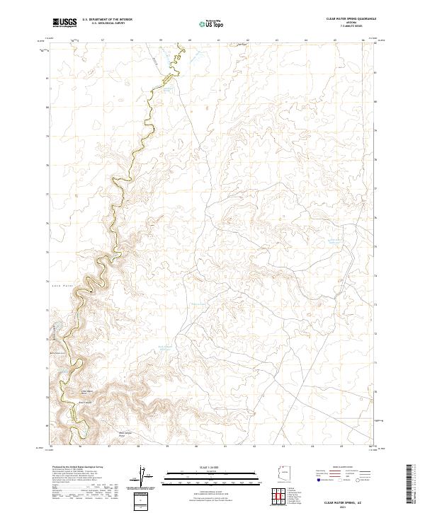
2021 Map of Clear Water Spring
USGS Topo · Published 2021About this map
The county line between Mohave and Coconino counties cuts through this high desert plateau, where deep canyons and seasonal washes define the movement of water and travelers alike. The path of Kanab Creek snakes through the western portion of the map, carving through the landscape near Loco Point and Burnt Canyon Point. Vital water sources are recorded throughout this arid terrain, including Quickwater Spring and the titular Clear Water Spring, alongside human-made improvements for livestock or irrigation like Filarea Tank and the Rock Canyon Reservoir. The layout of the land shows a clear transition from the drainage basins of Sandy Canyon Wash and Johnson Wash in the north toward the elevated landmarks of the south such as Rock Canyon Point.
Find a feature on this map
20 named features on this map. Tap any name to fly to it.
Don’t see what you’re looking for? This feature index may not catch every label — zoom into the map to look around manually.
Map Details
Editions of this 2021 Clear Water Spring Map
This is the sole edition of this map. No revisions or reprints were ever made.
Other maps of this area

1886 · Kaibab
USGS Topo · 1:250,000

1953 · Grand Canyon
USGS Topo · 1:250,000

1954 · Fredonia NW
USGS Topo · 1:24,000

1954 · Shinarump NW
USGS Topo · 1:24,000

1954 · Fredonia SW
USGS Topo · 1:24,000

1954 · Fredonia NE
USGS Topo · 1:24,000

1954 · Fredonia
USGS Topo · 1:62,500

1957 · Grand Canyon
USGS Topo · 1:250,000

1957 · Shinarump SW
USGS Topo · 1:24,000
1957 · Shinarump
USGS Topo · 1:62,500