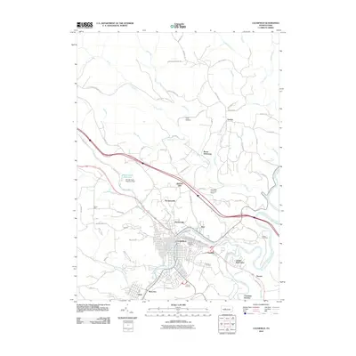
2010 Map of Clearfield
USGS Topo · Published 2010About this map
The West Branch Susquehanna River curves through this Pennsylvania landscape, serving as the historical and geographic anchor for the borough of Clearfield. In the early 21st century, the town's dense grid of streets is flanked by distinct neighborhoods and outlying communities such as Riverview, Hyde, and Plymptonville. The map captures a transitional geography where residential development meets the industrial and agricultural heritage of the region, evidenced by Golden Rod Farms and the Clearfield-Lawrence Airport. To the north and west, the terrain rises into the highlands of the Moshannon State Forest, marked by numerous tributary runs like Lick Run and Stone Run. Local history and genealogy are well-represented by several large interment sites, including Calvary Cemetery, Hillcrest Cemetery, and Fulton Cemetery, while the presence of the Moose Creek Reservoir Dam highlights the infrastructure required to manage the area's water resources.
Find a feature on this map
78 named features on this map. Tap any name to fly to it.
Don’t see what you’re looking for? This feature index may not catch every label — zoom into the map to look around manually.
Map Details
Editions of this 2010 Clearfield Map
This is the sole edition of this map. No revisions or reprints were ever made.
Other maps of this area

1903 · Curwensville
USGS Topo · 1:62,500

1903 · Houtzdale
USGS Topo · 1:62,500

1905 · Houtzdale
USGS Topo · 1:62,500

1929 · Clearfield
USGS Topo · 1:48,000

1929 · Penfield
USGS Topo · 1:62,500

1932 · Clearfield
USGS Topo · 1:62,500

1932 · Penfield
USGS Topo · 1:62,500

1939 · Curwensville
USGS Topo · 1:62,500

1942 · Curwensville
USGS Topo · 1:62,500

1943 · Punxsutawney
USGS Topo · 1:125,000