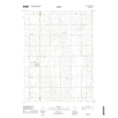
2018 Map of Clearfield
USGS Topo · Published 2018About this map
Clearfield anchors the western edge of this agricultural landscape along the Taylor Co Ringgold Co line. The settlement's street grid, including Broadway St, Jackson St, and Van Buren St, reflects a classic Midwestern town layout surrounded by a network of rural roads such as Tay-Gold Ave and Yellowstone Ave. The topography is defined by the drainage systems of the Platte River and its various tributaries, including Honey Cr and Turkey Cr, which create a series of subtle ridges and valleys across the countryside.
Find a feature on this map
49 named features on this map. Tap any name to fly to it.
Don’t see what you’re looking for? This feature index may not catch every label — zoom into the map to look around manually.
Map Details
Editions of this 2018 Clearfield Map
This is the sole edition of this map. No revisions or reprints were ever made.
Other maps of this area

1940 · Blockton
USGS Topo · 1:62,500

1940 · Bedford
USGS Topo · 1:62,500

1943 · Bedford
USGS Topo · 1:62,500

1943 · Blockton
USGS Topo · 1:62,500

1955 · Nebraska City
USGS Topo · 1:250,000

1957 · Nebraska City
USGS Topo · 1:250,000

1958 · Nebraska City
USGS Topo · 1:250,000

1980 · Merle Junction
USGS Topo · 1:24,000

1980 · Lenox
USGS Topo · 1:24,000
1980 · Conway
USGS Topo · 1:24,000