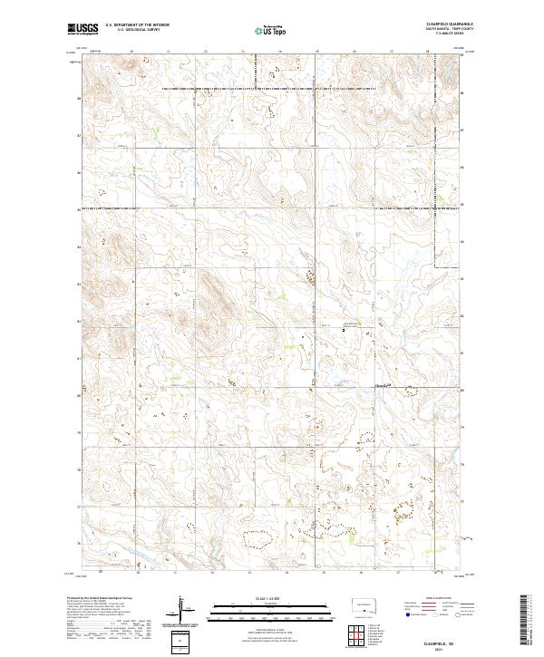
2021 Map of Clearfield
USGS Topo · Published 2021About this map
The unincorporated community of Clearfield centers this high plains landscape in Tripp County, where the grid of sections and section-line roads like 307th Ave and 292nd St defines the rural settlement pattern. This 2021 topographic record shows a land shaped by drainage and faith, notably featuring the Saint Boniface Catholic Cem north of the townsite along S Dakota Highway 53. The terrain is characterized by the winding path of Willow Cr through the central sections and the Keya Paha River crossing the southern reaches of the quadrangle. For genealogists and local historians, the map preserves the precise locations of rural infrastructure and religious landmarks that have anchored this South Dakota farming community for generations, while tracing the natural hydrologic network of Dog Ear Cr and its tributaries.
Find a feature on this map
25 named features on this map. Tap any name to fly to it.
Don’t see what you’re looking for? This feature index may not catch every label — zoom into the map to look around manually.
Map Details
Editions of this 2021 Clearfield Map
This is the sole edition of this map. No revisions or reprints were ever made.
Other maps of this area

1955 · Martin
USGS Topo · 1:250,000

1955 · Mitchell
USGS Topo · 1:250,000

1958 · Martin
USGS Topo · 1:250,000

1959 · Mitchell
USGS Topo · 1:250,000

1982 · Witten SE
USGS Topo · 1:25,000
1982 · Millboro
USGS Topo · 1:24,000

1982 · Keyapaha SE
USGS Topo · 1:24,000

1982 · Witten SW
USGS Topo · 1:25,000
1982 · Clearfield
USGS Topo · 1:24,000
1982 · Keyapaha NW
USGS Topo · 1:24,000