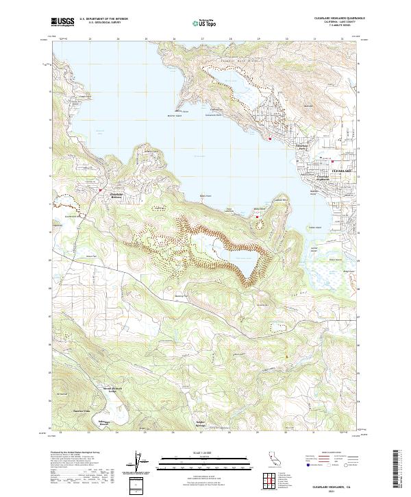
2021 Map of Clearlake Highlands
USGS Topo · Published 2021About this map
Clearlake Highlands and Clearlake Park anchor the eastern shoreline of Clear Lake, where residential streets meet the water at Jones Bay and Jago Bay. The landscape transitions from the developed resort communities of Clearlake Riviera and Sunrise Vista to the protected wetlands of Anderson Marsh along Cache Creek. In the south, the terrain rises toward Seigler Valley, home to Seigler Springs and the Salminas Resort, reflecting the area's legacy of mineral springs and seasonal retreats. Topographic details highlight the distinct volcanic geography, including the landlocked Borax Lake and Thurston Lake, as well as prominent elevations like Bald Mtn and Sulphur Bank Ridge. These features illustrate the complex hydrology and varied settlement patterns between the shore and the interior hills near Mount Hannah Lodge.
Find a feature on this map
189 named features on this map. Tap any name to fly to it.
Don’t see what you’re looking for? This feature index may not catch every label — zoom into the map to look around manually.
Map Details
Editions of this 2021 Clearlake Highlands Map
This is the sole edition of this map. No revisions or reprints were ever made.
Other maps of this area

1921 · Kelseyville
USGS Topo · 1:62,500

1924 · Bartlett Springs
USGS Topo · 1:62,500

1938 · Lakeport
USGS Topo · 1:62,500

1942 · Bartlett Springs
USGS Topo · 1:62,500

1943 · Kelseyville
USGS Topo · 1:62,500

1944 · Bartlett Springs
USGS Topo · 1:62,500

1945 · Lower Lake
USGS Topo · 1:62,500

1947 · Santa Rosa
USGS Topo · 1:250,000

1949 · Santa Rosa
USGS Topo · 1:250,000

1951 · Lakeport
USGS Topo · 1:62,500