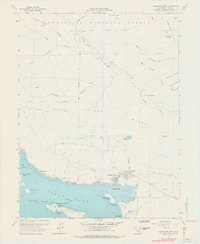
1958 Map of Clearlake Oaks
USGS Topo · Published 1967About this map
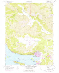
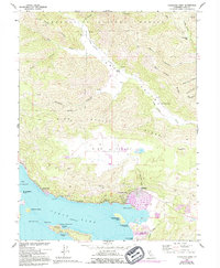
Clear Lake dominates the southern portion of this mid-century topographic survey, its shoreline dotted with islands and emerging resort communities like Glenhaven and Clearlake Oaks. The northern landscape is defined by the steep transitions of the Mendocino National Forest, where drainage systems like Long Valley Creek and Wolf Creek carve through High Valley Ridge. Significant local industry and land use are evident in the presence of the Sulphur Bank Mine and the Sulphur Bank Rancheria near the lake’s edge, as well as several gravel pits and ranching outposts such as Garner Ranch and Kennedy Ranch in the interior valleys. The map documents a period before extensive modern development, noting rural infrastructure like the East Lake Sch and various jeep trails that connect the high ridges to the waterfront.
Find a feature on this map
51 named features on this map. Tap any name to fly to it.
Don’t see what you’re looking for? This feature index may not catch every label — zoom into the map to look around manually.
Map Details
Editions of this 1958 Clearlake Oaks Map
7 editions found

Other maps of this area

1921 · Kelseyville
USGS Topo · 1:62,500

1924 · Bartlett Springs
USGS Topo · 1:62,500

1938 · Lakeport
USGS Topo · 1:62,500

1942 · Bartlett Springs
USGS Topo · 1:62,500

1943 · Kelseyville
USGS Topo · 1:62,500

1944 · Bartlett Springs
USGS Topo · 1:62,500

1945 · Lower Lake
USGS Topo · 1:62,500

1947 · Santa Rosa
USGS Topo · 1:250,000

1949 · Santa Rosa
USGS Topo · 1:250,000

1951 · Lakeport
USGS Topo · 1:62,500