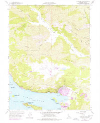
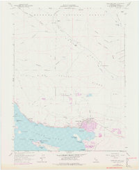
1958 Map of Clearlake Oaks
USGS Topo · Published 1978About this map
Clearlake Oaks and Glenhaven line the northern shores of Clear Lake, where the shoreline is defined by numerous points and islands. This 1958 survey, updated with 1975 photogrammetric data, reveals the industrial and cultural history of the eastern lakefront through features like the Sulphur Bank Mine and the Sulphur Bank Rancheria. The terrain rises sharply from the water toward High Valley Ridge, leading into the interior High Valley where High Valley Road connects remote outposts like Garner Ranch and Kennedy Ranch. The map captures the interface between the lake’s recreational and residential development and the protected lands of the Mendocino National Forest. Significant water features such as Indian Beach, Paradise Cove, and the various islands—including Rattlesnake Island and Stubbs Island—illustrate the complex geography that has drawn people to this part of Lake County for generations.
Find a feature on this map
41 named features on this map. Tap any name to fly to it.
Don’t see what you’re looking for? This feature index may not catch every label — zoom into the map to look around manually.
Map Details
Editions of this 1958 Clearlake Oaks Map
7 editions found

Other maps of this area

1921 · Kelseyville
USGS Topo · 1:62,500

1924 · Bartlett Springs
USGS Topo · 1:62,500

1938 · Lakeport
USGS Topo · 1:62,500

1942 · Bartlett Springs
USGS Topo · 1:62,500

1943 · Kelseyville
USGS Topo · 1:62,500

1944 · Bartlett Springs
USGS Topo · 1:62,500

1945 · Lower Lake
USGS Topo · 1:62,500

1947 · Santa Rosa
USGS Topo · 1:250,000

1949 · Santa Rosa
USGS Topo · 1:250,000

1951 · Lakeport
USGS Topo · 1:62,500