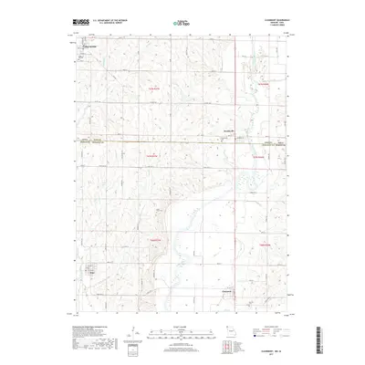
2017 Map of Clearmont
USGS Topo · Published 2017About this map
The Nodaway River meanders across the border of Iowa and Missouri, anchoring a rural landscape defined by small agricultural hubs and scattered local history markers. This 2017 survey shows the proximity of College Springs and Braddyville in Page County, Iowa, to the neighboring Missouri settlements of Elmo and Clearmont in Nodaway County. The terrain is marked by numerous watercourses including E Mill Cr, Buchanan Cr, and Sink Cr, which drain the surrounding farmland. Genealogists can identify several local burial grounds that have served these communities for generations, such as Maple Hill Cem, Union Grove Cem, Braddyville Cem, and Oak Hill Cem. The map provides a contemporary view of the region's road network, from state routes like State Hwy D and State Hwy KK to the section-line gravel roads that continue to define the rural Midwest's spatial organization.
Find a feature on this map
70 named features on this map. Tap any name to fly to it.
Don’t see what you’re looking for? This feature index may not catch every label — zoom into the map to look around manually.
Map Details
Editions of this 2017 Clearmont Map
This is the sole edition of this map. No revisions or reprints were ever made.
Other maps of this area

1939 · Skidmore
USGS Topo · 1:62,500

1940 · Coin
USGS Topo · 1:62,500

1940 · New Market
USGS Topo · 1:62,500

1941 · Skidmore
USGS Topo · 1:62,500

1942 · Skidmore
USGS Topo · 1:62,500

1943 · Coin
USGS Topo · 1:62,500

1943 · Maryville
USGS Topo · 1:62,500

1943 · New Market
USGS Topo · 1:62,500

1955 · Nebraska City
USGS Topo · 1:250,000

1957 · Nebraska City
USGS Topo · 1:250,000