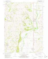
1981 Map of Clearmont
USGS Topo · Published 1981About this map
Clearmont and Braddyville anchor this 1981 study of the borderlands between Page and Nodaway counties. The Nodaway River meanders south across the Iowa Missouri state line, flanked by an Old Railroad Grade that speaks to the shifting transportation networks of the late twentieth century. In the southwest, the town of Elmo is served by the Norfolk and Western railroad, highlighting the continued importance of rail transit for these agricultural communities.
Find a feature on this map
27 named features on this map. Tap any name to fly to it.
Don’t see what you’re looking for? This feature index may not catch every label — zoom into the map to look around manually.
Map Details
Editions of this 1981 Clearmont Map
This is the sole edition of this map. No revisions or reprints were ever made.
Other maps of this area

1939 · Skidmore
USGS Topo · 1:62,500

1940 · Coin
USGS Topo · 1:62,500

1940 · New Market
USGS Topo · 1:62,500

1941 · Skidmore
USGS Topo · 1:62,500

1942 · Skidmore
USGS Topo · 1:62,500

1943 · Coin
USGS Topo · 1:62,500

1943 · Maryville
USGS Topo · 1:62,500

1943 · New Market
USGS Topo · 1:62,500

1955 · Nebraska City
USGS Topo · 1:250,000

1957 · Nebraska City
USGS Topo · 1:250,000