Loading...
Loading map...2021 Map of Clearmont
USGS Topo · Published 2021About this map
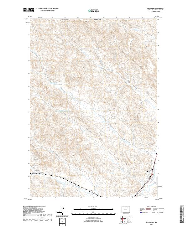
Clearmont serves as the primary hub in this Sheridan County landscape, situated at the confluence of the Town Draw and Clear Creek. The town's grid is clearly defined by local thoroughfares such as Devon St and Front St, with the Sunnybrook Cem located just to the north. This area reflects a long-standing reliance on water management in the high plains, evidenced by the extensive Pratt and Ferris Ditch Number 2 and upland water storage like Snider Reservoir Number 6.
Find a feature on this map
27 named features on this map. Tap any name to fly to it.
Don’t see what you’re looking for? This feature index may not catch every label — zoom into the map to look around manually.
Map Details
Date Portrayed2021
Date Published2021
PublisherU.S. Geological Survey
Map TypeTopographic
Scale1:24,000
Physical Dimensions24 x 29 inches
Editions of this 2021 Clearmont Map
This is the sole edition of this map. No revisions or reprints were ever made.
Historical Maps of Clearmont Through Time
Featured Locations
Source Details
SourceU.S. Geological Survey
CopyrightPublic Domain