
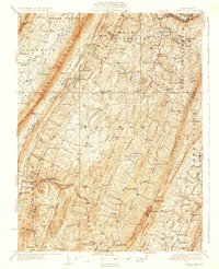
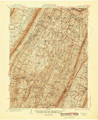
1931 Map of Clearville
USGS Topo · Published 1931About this map
Tussey Mountain and Warrior Ridge dominate this corner of Bedford County, where the topography of the Ridge and Valley Province strictly dictates human movement. The Lincoln Highway cuts across the northern reaches, while the rest of the landscape is defined by long, narrow valleys connected by occasional breaks like Mc Kees Gap. These valleys support a dense network of early 20th-century rural life, featuring countless family-named landmarks and local institutions. Small communities such as Clearville and Chaneysville serve as hubs for the surrounding farmsteads, while the industrial legacy of the region is visible at Jackson Mills and Silver Mills. For researchers, the map provides precise locations for scattered hilltop schools like Barkman Sch and Oak Grove Sch, alongside country churches including St Marks Ch and Stevens Chapel.
Find a feature on this map
106 named features on this map. Tap any name to fly to it.
Don’t see what you’re looking for? This feature index may not catch every label — zoom into the map to look around manually.
Map Details
Editions of this 1931 Clearville Map
3 editions found
Other maps of this area

1898 · Paw Paw
USGS Topo · 1:62,500

1899 · Flintstone
USGS Topo · 1:62,500

1899 · Hancock
USGS Topo · 1:62,500

1900 · Pawpaw
USGS Topo · 1:62,500

1900 · Flintstone
USGS Topo · 1:62,500

1900 · Everett
USGS Topo · 1:62,500

1901 · Hancock
USGS Topo · 1:62,500

1902 · Everett
USGS Topo · 1:62,500

1908 · Bedford
USGS Topo · 1:62,500

1910 · Bedford
USGS Topo · 1:62,500
Featured Places
- Colerain Township, PA
- Bedford Township, PA
- West Providence Township, PA
- Inglesmith, Mann Township
- Bethel Township, PA