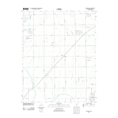
2012 Map of Clearwater
USGS Topo · Published 2012About this map
The Ninnescah River snakes through the southern reaches of this Sedgwick County landscape, defining the topography near the settlement of Clearwater. This 2012 survey illustrates a transition from the structured agricultural grid to localized industrial activity, evidenced by the Clearwater Oil Field and Chambers Northeast Oil Field situated to the east. For those documenting local families, the map identifies several significant burial sites, including the Old Saint Johns Cem and Saint Johns Cem near the community of Clonmel, along with Ruby Cem and Clearwater Cem. Water features are central to the area's layout, with Lake Afton in the northwest and Lake Waltanna, which is accompanied by the Lake Waltanna Airport. The terrain is further drained by Afton Cr, Spring Cr, and Dry Cr, which cut across the section lines of the rural Kansas plains.
Find a feature on this map
54 named features on this map. Tap any name to fly to it.
Don’t see what you’re looking for? This feature index may not catch every label — zoom into the map to look around manually.
Map Details
Editions of this 2012 Clearwater Map
This is the sole edition of this map. No revisions or reprints were ever made.
Other maps of this area

1889 · Cheney
USGS Topo · 1:125,000

1889 · Wichita
USGS Topo · 1:125,000

1889 · Caldwell
USGS Topo · 1:125,000

1890 · Wellington
USGS Topo · 1:125,000

1891 · Cheney
USGS Topo · 1:125,000

1893 · Caldwell
USGS Topo · 1:125,000

1894 · Wichita
USGS Topo · 1:125,000

1897 · Caldwell
USGS Topo · 1:125,000

1901 · Cheney
USGS Topo · 1:125,000

1943 · Wichita West
USGS Topo · 1:31,680