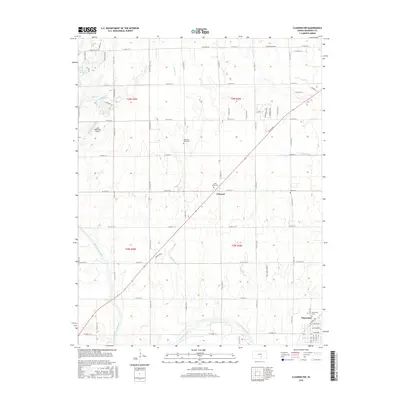
2015 Map of Clearwater
USGS Topo · Published 2015About this map
Ninnescah River meanders across the southern portion of this landscape, anchoring the township of Clearwater. The area is defined by a grid of rural roads and water features such as Lake Afton and Lake Waltanna, the latter accompanied by the Lake Waltanna Airport. In the heart of the township lies Clonmel, a small community situated near several significant landmarks for family researchers. Multiple burial grounds, including Old Saint Johns Cem, Saint Johns Cem, and Ruby Cem, are distributed across the plains, marking the generations of local families. The terrain rises subtly at Amber Ridge west of Spring Cr, while the northern reaches are drained by Afton Cr and Dry Cr. This 2015 edition captures the established agricultural and residential patterns of Sedgwick County, showing the persistent layout of section lines and watercourses.
Find a feature on this map
35 named features on this map. Tap any name to fly to it.
Don’t see what you’re looking for? This feature index may not catch every label — zoom into the map to look around manually.
Map Details
Editions of this 2015 Clearwater Map
This is the sole edition of this map. No revisions or reprints were ever made.
Other maps of this area

1889 · Cheney
USGS Topo · 1:125,000

1889 · Wichita
USGS Topo · 1:125,000

1889 · Caldwell
USGS Topo · 1:125,000

1890 · Wellington
USGS Topo · 1:125,000

1891 · Cheney
USGS Topo · 1:125,000

1893 · Caldwell
USGS Topo · 1:125,000

1894 · Wichita
USGS Topo · 1:125,000

1897 · Caldwell
USGS Topo · 1:125,000

1901 · Cheney
USGS Topo · 1:125,000

1943 · Wichita West
USGS Topo · 1:31,680