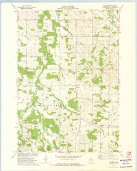
1973 Map of Cleghorn
USGS Topo · Published 1975About this map
Cleghorn sits at the intersection of a vast agricultural network in Eau Claire County, characterized by a series of north-south and east-west country roads named for the trees and families of the region. This 1973 survey illustrates the rural development of Washington and Pleasant Valley townships, where the landscape is defined by the winding paths of Lowes Creek, Clear Creek, and Otter Creek. Notable for genealogists, the map identifies several local burial grounds including Hadleyville Cem, Zion Cem, and Union Cem. A unique piece of local aviation history is preserved with the marking of Martinkas Landing Field, while the Pumping Station and crossing Pipeline indicate the infrastructure supporting the valley during the early 1970s.
Find a feature on this map
45 named features on this map. Tap any name to fly to it.
Don’t see what you’re looking for? This feature index may not catch every label — zoom into the map to look around manually.
Map Details
Editions of this 1973 Cleghorn Map
This is the sole edition of this map. No revisions or reprints were ever made.
Other maps of this area

1927 · Strum
USGS Topo · 1:62,500

1930 · Strum
USGS Topo · 1:62,500

1932 · Mondovi
USGS Topo · 1:62,500

1934 · Elk Mound
USGS Topo · 1:62,500

1934 · Chippewa Falls
USGS Topo · 1:62,500

1936 · Chippewa Falls
USGS Topo · 1:62,500

1936 · Elk Mound
USGS Topo · 1:62,500

1953 · Eau Claire
USGS Topo · 1:250,000

1958 · Eau Claire
USGS Topo · 1:250,000

1964 · Eau Claire
USGS Topo · 1:250,000