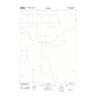
2012 Map of Cleghorn Flat
USGS Topo · Published 2012About this map
Cleghorn Flat characterizes this Lassen County landscape, where water management and ranching infrastructure define the high desert terrain. The map reveals an intricate network of water resources, including Bailey Reservoir, Glade Reservoir, and Pinecone Reservoir, all vital for sustaining life in this arid environment. Significant natural features like Whiskey Canyon and Chase Canyon provide topographic variation, while the Dry Valley to the north holds the Dry Valley Cem, a key landmark for local genealogical research. The presence of named roads such as Termo Grasshopper Rd and Prairie Dr indicates a settled but rural layout, connecting scattered sites like McCoy Flat to the broader county network.
Find a feature on this map
24 named features on this map. Tap any name to fly to it.
Don’t see what you’re looking for? This feature index may not catch every label — zoom into the map to look around manually.
Map Details
Editions of this 2012 Cleghorn Flat Map
This is the sole edition of this map. No revisions or reprints were ever made.
Other maps of this area

1886 · Honey Lake
USGS Topo · 1:250,000

1891 · Honey Lake
USGS Topo · 1:250,000

1893 · Honey Lake
USGS Topo · 1:250,000

1954 · Karlo
USGS Topo · 1:62,500

1954 · Grasshopper Valley
USGS Topo · 1:62,500

1954 · Ravendale
USGS Topo · 1:62,500

1954 · Fredonyer Peak
USGS Topo · 1:62,500

1955 · Westwood
USGS Topo · 1:250,000

1958 · Westwood
USGS Topo · 1:250,000

1959 · Westwood
USGS Topo · 1:250,000