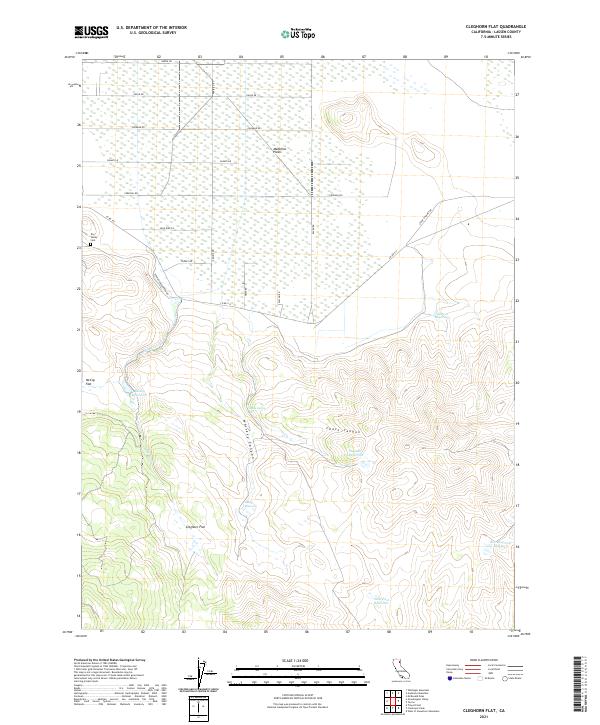
2021 Map of Cleghorn Flat
USGS Topo · Published 2021About this map
Madeline Plains and the expansive basin of Cleghorn Flat characterize this high-desert landscape in Lassen County, documented by the USGS in 2021. The map reveals a transition from the broad, open flats of McCoy Flat in the west to the deeply carved drainages of Whiskey Canyon and Chase Canyon in the south. This terrain is marked by an extensive network of water management features, including Bailey Reservoir, Elmers Reservoir, and Steel Post Reservoir, reflecting the importance of water storage in this arid environment. Genealogy interests are anchored by the Dry Valley Cem located near the intersection of several local roads. The road network itself carries a distinct avian theme, featuring names like Canary Rd, Cardinal Rd, and Blue Bird Ln, which suggests a modern layer of naming over a landscape historically defined by its canyons and seasonal creeks like Bailey Cr.
Find a feature on this map
31 named features on this map. Tap any name to fly to it.
Don’t see what you’re looking for? This feature index may not catch every label — zoom into the map to look around manually.
Map Details
Editions of this 2021 Cleghorn Flat Map
This is the sole edition of this map. No revisions or reprints were ever made.
Other maps of this area

1886 · Honey Lake
USGS Topo · 1:250,000

1891 · Honey Lake
USGS Topo · 1:250,000

1893 · Honey Lake
USGS Topo · 1:250,000

1954 · Karlo
USGS Topo · 1:62,500

1954 · Grasshopper Valley
USGS Topo · 1:62,500

1954 · Ravendale
USGS Topo · 1:62,500

1954 · Fredonyer Peak
USGS Topo · 1:62,500

1955 · Westwood
USGS Topo · 1:250,000

1958 · Westwood
USGS Topo · 1:250,000

1959 · Westwood
USGS Topo · 1:250,000