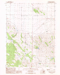
1989 Map of Cleghorn Flat
USGS Topo · Published 1989About this map
The Madeline Plains dominate the northern reaches of this Lassen County terrain, giving way to the complex topography of Cleghorn Flat to the south. This 1989 provisional survey captures a landscape defined by water management and remote landmarks, notably the Dry Valley Cemetery located near the western margin. The region's reliance on seasonal and spring-fed water sources is evident through a network of small catchments, including Pinecone Reservoir, Steel Post Reservoir, and Elmers Reservoir.
Find a feature on this map
18 named features on this map. Tap any name to fly to it.
Don’t see what you’re looking for? This feature index may not catch every label — zoom into the map to look around manually.
Map Details
Editions of this 1989 Cleghorn Flat Map
This is the sole edition of this map. No revisions or reprints were ever made.
Other maps of this area

1886 · Honey Lake
USGS Topo · 1:250,000

1891 · Honey Lake
USGS Topo · 1:250,000

1893 · Honey Lake
USGS Topo · 1:250,000

1954 · Karlo
USGS Topo · 1:62,500

1954 · Grasshopper Valley
USGS Topo · 1:62,500

1954 · Ravendale
USGS Topo · 1:62,500

1954 · Fredonyer Peak
USGS Topo · 1:62,500

1955 · Westwood
USGS Topo · 1:250,000

1958 · Westwood
USGS Topo · 1:250,000

1959 · Westwood
USGS Topo · 1:250,000