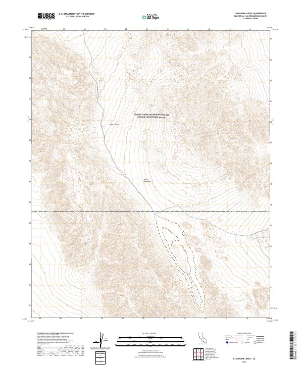
2021 Map of Cleghorn Lakes
USGS Topo · Published 2021About this map
The Bullion Mountains rise through the eastern reaches of the Mojave Desert in this detailed topographic study. The landscape is defined by the high, arid peaks and drainage patterns of the range, with contours revealing the complex topography of the southern California interior. The map illustrates the Public Land Survey System grid, demarcating boundaries such as t3n r11e and t2n r12e across the open desert. This modern record by the U.S. Geological Survey preserves the physical geography of the region, providing a foundation for understanding the natural boundaries and land divisions in San Bernardino County.
Find a feature on this map
6 named features on this map. Tap any name to fly to it.
Don’t see what you’re looking for? This feature index may not catch every label — zoom into the map to look around manually.
Map Details
Editions of this 2021 Cleghorn Lakes Map
This is the sole edition of this map. No revisions or reprints were ever made.
Other maps of this area

1942 · Amboy
USGS Topo · 1:250,000

1943 · Amboy
USGS Topo · 1:250,000

1954 · Needles
USGS Topo · 1:250,000

1954 · Bristol Lake NW
USGS Topo · 1:24,000

1954 · Bristol Lake SW
USGS Topo · 1:24,000

1954 · Valley Mtn
USGS Topo · 1:24,000

1955 · Lead Mountain
USGS Topo · 1:24,000

1955 · Lead Mtn. NE
USGS Topo · 1:24,000

1955 · Lead Mountain SW
USGS Topo · 1:24,000
1955 · Cleghorn Lakes
USGS Topo · 1:24,000