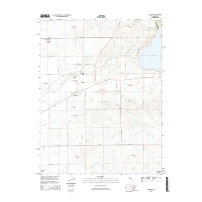
2015 Map of Clements
USGS Topo · Published 2015About this map
Clements and the neighboring settlement of Dogtown sit at a geographic transition where the Sacramento Valley meets the lower foothills. The Mokelumne River winds through the center of the landscape, feeding into the southern reaches of the Camanche Reservoir. This 2015 survey illustrates a rural corridor defined by agricultural grid roads and small-scale creek systems, including Coyote Cr, Bear Cr, and Murphy Cr. For genealogists and local historians, the Clements Glen View Cemetery remains a primary landmark along E Mehrten Rd, while the Mokelumne Beach area indicates a site of recreational or local interest along the riverbank. The presence of the Mokelumne Aqueduct running through the southern sections highlights the critical role of water infrastructure in the San Joaquin Valley interior.
Find a feature on this map
45 named features on this map. Tap any name to fly to it.
Don’t see what you’re looking for? This feature index may not catch every label — zoom into the map to look around manually.
Map Details
Editions of this 2015 Clements Map
This is the sole edition of this map. No revisions or reprints were ever made.
Other maps of this area

1889 · Jackson
USGS Topo · 1:125,000

1892 · Jackson
USGS Topo · 1:125,000

1894 · Lodi
USGS Topo · 1:125,000

1897 · Jackson
USGS Topo · 1:125,000

1902 · Jackson
USGS Topo · 1:125,000

1908 · Waterloo
USGS Topo · 1:31,680

1908 · Linden
USGS Topo · 1:31,680

1908 · Lockeford
USGS Topo · 1:31,680

1909 · Clay
USGS Topo · 1:31,680

1909 · Goose Creek
USGS Topo · 1:31,680