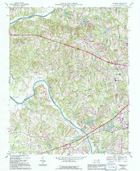
1968 Map of Clemmons
USGS Topo · Published 1994About this map
The Yadkin River defines the western edge of this landscape, carving through the Yadkin Valley at the border of Forsyth, Yadkin, and Davie Counties. This survey reflects a period of mid-century suburban expansion around Clemmons and Lewisville, while maintaining its rural character through numerous family-named roads and small community hubs. To the south, Tanglewood Park occupies a large bend in the river, anchoring a recreational corridor that includes Mallard Lake and several golf courses.
Find a feature on this map
57 named features on this map. Tap any name to fly to it.
Don’t see what you’re looking for? This feature index may not catch every label — zoom into the map to look around manually.
Map Details
Editions of this 1968 Clemmons Map
3 editions found
Other maps of this area

1891 · Yadkinville
USGS Topo · 1:125,000

1893 · Statesville
USGS Topo · 1:125,000

1893 · Yadkinville
USGS Topo · 1:125,000

1950 · Winston-Salem West
USGS Topo · 1:24,000

1951 · Winston-Salem West
USGS Topo · 1:24,000

1951 · Rural Hall
USGS Topo · 1:24,000

1953 · Charlotte
USGS Topo · 1:250,000

1953 · Winston-Salem
USGS Topo · 1:250,000

1954 · Charlotte
USGS Topo · 1:250,000

1955 · Winston-Salem
USGS Topo · 1:250,000