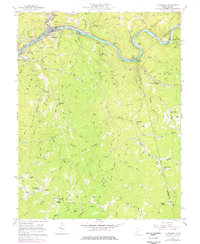
1957 Map of Clendenin
USGS Topo · Published 1977About this map
The Elk River winds sharply through Kanawha and Clay counties, anchoring a landscape where river-bottom rail lines meet steep Appalachian ridges. During the mid-20th century, the Baltimore and Ohio railroad corridor served as the industrial spine for settlements like Clendenin, Corton, and Queen Shoals. While the riverbanks supported transportation and utility infrastructure—evidenced by the Gaging Sta and numerous gas wells—the interior ridges remained dotted with rural institutions.
Find a feature on this map
67 named features on this map. Tap any name to fly to it.
Don’t see what you’re looking for? This feature index may not catch every label — zoom into the map to look around manually.
Map Details
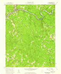
Editions of this 1957 Clendenin Map
2 editions found
Other maps of this area

1897 · Kanawha Falls
USGS Topo · 1:125,000

1900 · Kanawha Falls
USGS Topo · 1:125,000

1901 · Kanawha Falls
USGS Topo · 1:125,000

1906 · Otter
USGS Topo · 1:62,500

1906 · Walton
USGS Topo · 1:62,500

1907 · Otter
USGS Topo · 1:62,500

1907 · Walton
USGS Topo · 1:62,500

1907 · Clendenin
USGS Topo · 1:62,500

1908 · Clay
USGS Topo · 1:48,000

1909 · Clendenin
USGS Topo · 1:62,500