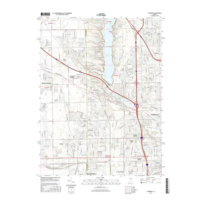
2016 Map of Clermont
USGS Topo · Published 2016About this map
The Eagle Cr Reservoir and its surrounding parklands dominate the central landscape of this western Indianapolis region, where suburban expansion meets the Hendricks and Marion county line. The community of Clermont serves as a central hub, flanked by residential developments like Clermont Heights and Westwood. Transportation history is visible through the CSX rail line and the historic Crawfordsville Rd corridor, which once served as a primary route into the city. Local history is deeply rooted in several early burial grounds, including the Old Union Cem, Jones Chapel Cem, and Ballard Cem. Aviation also plays a significant role in the area's development, evidenced by the presence of Eagle Creek Airpark and the Newby Landing Airport, alongside specialized facilities like the Aviation Institute of Maintenance-Indianapolis.
Find a feature on this map
85 named features on this map. Tap any name to fly to it.
Don’t see what you’re looking for? This feature index may not catch every label — zoom into the map to look around manually.
Map Details
Editions of this 2016 Clermont Map
This is the sole edition of this map. No revisions or reprints were ever made.
Other maps of this area

1948 · Maywood
USGS Topo · 1:24,000

1948 · Indianapolis West
USGS Topo · 1:24,000

1952 · Carmel
USGS Topo · 1:24,000

1953 · Bridgeport
USGS Topo · 1:24,000

1953 · Fayette
USGS Topo · 1:24,000

1953 · Brownsburg
USGS Topo · 1:24,000

1953 · Zionsville
USGS Topo · 1:24,000

1953 · Plainfield
USGS Topo · 1:24,000

1953 · Clermont
USGS Topo · 1:24,000

1953 · Indianapolis
USGS Topo · 1:250,000