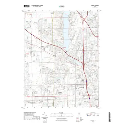
2019 Map of Clermont
USGS Topo · Published 2019About this map
Eagle Creek Reservoir and the Hendricks County and Marion County line dominate this landscape, where suburban growth and older rural landmarks converge. The sheet documents a high density of burial sites for genealogists, including family and church-affiliated plots like Turpin Cem, Old Union Cem, and Shiloh Methodist Cem. Significant water features such as E Fork White Lick Cr and Mud Run define the drainage patterns around the established town of Brownsburg and the smaller community of Clermont. Transportation is anchored by Crawfordsville Rd and the Ronald Reagan Pkwy, while the Eagle Creek Airpark marks the western approach to the metropolitan area. The map illustrates various residential developments ranging from Clermont Heights to the south-central neighborhood of Keystone Manor.
Find a feature on this map
69 named features on this map. Tap any name to fly to it.
Don’t see what you’re looking for? This feature index may not catch every label — zoom into the map to look around manually.
Map Details
Editions of this 2019 Clermont Map
This is the sole edition of this map. No revisions or reprints were ever made.
Other maps of this area

1948 · Maywood
USGS Topo · 1:24,000

1948 · Indianapolis West
USGS Topo · 1:24,000

1952 · Carmel
USGS Topo · 1:24,000

1953 · Bridgeport
USGS Topo · 1:24,000

1953 · Fayette
USGS Topo · 1:24,000

1953 · Brownsburg
USGS Topo · 1:24,000

1953 · Zionsville
USGS Topo · 1:24,000

1953 · Plainfield
USGS Topo · 1:24,000

1953 · Clermont
USGS Topo · 1:24,000

1953 · Indianapolis
USGS Topo · 1:250,000