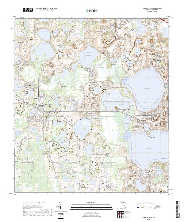
2024 Map of Clermont West
USGS Topo · Published 2024About this map
Clermont and its neighboring citrus-belt settlements of Groveland, Mascotte, and Minneola define the landscape of this central Florida region. The area is dominated by an intricate chain of lakes connected by the Palatlakaha River, including the expansive Lake Minneola and Lake Minnehaha. This modern topographic survey highlights a transition from dense residential development near the lakefronts to the rural pockets where small aviation sites like Osborn Airfield and Sheets Airport remain active.
Find a feature on this map
65 named features on this map. Tap any name to fly to it.
Don’t see what you’re looking for? This feature index may not catch every label — zoom into the map to look around manually.
Map Details
Editions of this 2024 Clermont West Map
This is the sole edition of this map. No revisions or reprints were ever made.
Other maps of this area

1955 · Orlando
USGS Topo · 1:250,000

1957 · Orlando
USGS Topo · 1:250,000

1958 · Orlando
USGS Topo · 1:250,000

1959 · Lake Nellie
USGS Topo · 1:24,000

1959 · Lake Louisa
USGS Topo · 1:24,000
1960 · Bay Lake
USGS Topo · 1:24,000

1962 · Orlando
USGS Topo · 1:250,000

1962 · Clermont East
USGS Topo · 1:24,000

1962 · Astatula
USGS Topo · 1:24,000
1969 · Center Hill
USGS Topo · 1:24,000