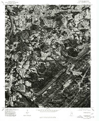
1975 Map of Cleveland
USGS Topo · Published 1977About this map
Cleveland and the surrounding Blount County landscape are revealed in this 1975 aerial orthophotomap, showing a detailed view of the rural patterns of central Alabama. The meandering course of the Locust Fork creates a distinct corridor through the terrain, its winding path shaping the layout of the local roads and small farm plots. To the south, the settlement of Allgood anchors a more industrial or concentrated area compared to the agrarian expanses seen elsewhere on the sheet. Produced in cooperation with the Soil Conservation Service, this imagery captures the specific land-use patterns of the mid-1970s, from the clearings for agriculture to the dense woodland along the riverbanks. This specific format highlights the physical geography of the River and its various tributaries like the Prong, providing a photographic record of the territory before later decades of development and forest regrowth altered the visual landscape.
Find a feature on this map
5 named features on this map. Tap any name to fly to it.
Don’t see what you’re looking for? This feature index may not catch every label — zoom into the map to look around manually.
Map Details
Editions of this 1975 Cleveland Map
This is the sole edition of this map. No revisions or reprints were ever made.
Other maps of this area

1885 · Gadsden
USGS Topo · 1:125,000

1888 · Cullman
USGS Topo · 1:125,000

1888 · Gadsden
USGS Topo · 1:125,000

1889 · Springville
USGS Topo · 1:125,000

1889 · Birmingham
USGS Topo · 1:125,000

1892 · Cullman
USGS Topo · 1:125,000

1892 · Birmingham
USGS Topo · 1:125,000

1892 · Springville
USGS Topo · 1:125,000

1892 · Gadsden
USGS Topo · 1:125,000

1895 · Gadsden
USGS Topo · 1:125,000